
具體描述
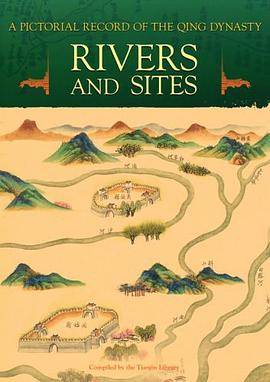
A Pictorial Record of the Qing Dynasty - Rivers and Sites , includes two major categories of maps: river maps and maps of historical sites.
China was an agrarian society during medieval times, and harnessing rivers played an important role in sustaining social development. A Compendium on Harnessing Rivers, which was completed in the 42nd year of Emperor Kangxi s reign (1703), contains a large number of valuable pictures compiled and edited by Zhang Penghe, the governor-general in charge of rivers. The book also contains maps of various rivers drawn by anonymous artists. They record the vicissitudes of rivers and areas along the banks while at the same time realistically tracing the shapes of city walls, places of historical interest, and beauty spots along the rivers.
As a mother river of the Chinese nation, the Yellow River has always been the focus of much attention, resulting in more ancient Chinese maps of this river than any other in China. This book collects many maps of the Yellow River made during the late Qing period, most of which also record in writing the dates of the crevasse and the closure of a certain section of the river and the deployment of soldiers guarding it. A Complete Map of the Yellow River within Shandong, A Map of the Yellow River within the Whole Province of Shandong, A Concise Complete Map of the Yellow River within Shandong are among the maps presented in this book.
Other maps available include Maps of the Rivers under Baoding Prefecture, Maps of the Rivers under Zhengding Prefecture, and Maps of the Rivers under the Five Prefectures of Zhili Ji, Zhao, Shen, Ding, and Yi.
In addition, there are three maps of historical interest: Maps of His Majesty s Temporary Dwelling Palaces on His Return Journey, Maps of Dagu Batteries, and Illustrations of Wendeng, Weihai, and Other Historical Sites. .
KEY FEATURES
- Rivers and Sites is the third book in A Pictorial Record of the Qing Dynasty series. The other three books are entitled Business Documents (Released May 2008), Old Manchu Capital (Released June 2008), and Manchurian Railway (to be release November 2008).
- Consisting of over 400 maps that appear in chronological order in ten categories, each decorated with colored drawings.
- Original images and full color
著者簡介
圖書目錄
讀後感
評分
評分
評分
評分
用戶評價
相關圖書
本站所有內容均為互聯網搜索引擎提供的公開搜索信息,本站不存儲任何數據與內容,任何內容與數據均與本站無關,如有需要請聯繫相關搜索引擎包括但不限於百度,google,bing,sogou 等
© 2025 book.quotespace.org All Rights Reserved. 小美書屋 版权所有


