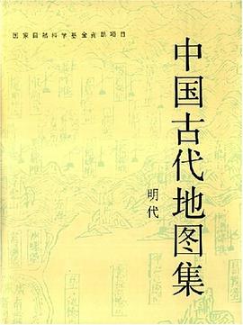

具体描述
搜集、整理、汇编古文献,虽不是创造性的文化建设工作,但对文化保存、传布所作出的贡献是很大的,可以说不下于,有时甚至有过于创作者。
《汉书·地理志》和《水经注》是两种具有重大价值的中国古代地理名著,中国文化宝库中能拥有这两部名著,当然得归功于班固和郦道元,但班、郦二人的贡献,主要不在于二人自己的撰述,而在于他们把许多有价值的原始地理著作搜罗汇编在一起,从而使这些宝贵资料不至于散佚失传,得以传诸后世以至于今,要是没有班、郦,这么许多价值很高而篇幅短小的原始作品,就不可能流传下来。
作者简介
目录信息
Foreward
凡例
Introduction
图版目录
List of Plates
图版
Plates
图版说明
Notes on the Plates
绢本彩绘大明混一图研究
As Regards the Da Ming Hun Yi Tu(Amalgamated Map of the Great Ming Dynasty)Drawn in Colours on Stiff Silk
郑和航海图在我国古代地图发展史中的地位
Zheng He's Nautical Charts and Their Position in the Histor of Ancient China's Cartography
从苏洲府城图看明代苏州经济的发展
The Development of the Ecomomy of Suzhou in the Ming Dynasty As Seen from Su Zhou Fu Cheng Tu(Map of Suzhou Prefectural City) 杨子器跋舆地图及其图式符号
Yu Di Tu(Terrestrial Map)with a Postscript by Yang Ziqi and Its Legends and Symbols
明彩绘九边图研究
A Study of Jiu Bian Tu(Map of the Nine Strategic Posts)Drawn in Colours During the Ming Dynasty 郑若曾的万里海防图及其影响
Zheng Ruozeng's Wan Li Hai Fang Tu(Map of 10000 Li of Coast Defence)and Its Impact
广舆图在中国地图学史上的地位及其影响
The Contribution of Guand Yu Tu(Enlargad Terrestrial Atlas)in the History of Chinese Cartography and Its Impact
堪舆地图初探 On Geomantic Maps
明代徽商绘的两幅图
Two Maps of Journeys Compiled and Drawn by Merchants of Anhui During the Ming Dynasty
两幅明代传统星图初探
A Tentative Inquiry into Two Star Maps of the Ming Dynasty
明蓟门汤泉图考
An Inspection of the Ming Map of Tangquan of the Jimen Strategic Post
万历永安县志和惠州府志中的地图研究
A Study of the Maps in Yong An Xian Zhi and Hui Zhou Fu Zhi
潘季驯河防一览图考
An Investigation into Pan Jixun's He Fand Yi Lan Tu(Map of a General Survey of Flood-prevention Work Done on Rivers)
彩绘申懋九边图残卷
The Damaged Jiu Bian Tu Drawn in Colours by Shen Yongmao
论利玛窦坤舆万国全图和两仪玄览图上的序跋题识
As Regards the Prefaces,Postscripts and Inscriptions in Matteo Ricci's Kun Yu Wan Guo Quan Tu and Liang Yi Xuan Lan Tu
王泮题识舆地图朝鲜摹绘增补本初探
A Trial Inquiry into the Supplemented Korean Reproduction of Yu Di Tu(Terrestrial Map)with an Inscription by Wand Pang
现在最早在中国制作的一架地球仪
The Earliest Extant Terrestrial Globe Made in China
明末吴中水利全书所载苏州府城内水道总图初探
An Initial Inquiry into Suzhou Fu CHeng Nei Shui Dao Zong Tu Included in Wu Zhong Shui Li Quan Shu Completed towards the End of the Ming Dynasty
英文提要
Summaries of the Papers in English
中国地学图史大事记(明代)
A Chronicle of Events of the History of Cartography in China(the Ming Dynasty)
后记
Postscript
· · · · · · (收起)
读后感
评分
评分
评分
评分
用户评价
这次的阅读体验,也让我对古代的知识传播体系有了全新的认识。我手上的这本,特别收录了几种不同地域、不同流派的制图方法,有些是受西方传入的几何学影响较深的,线条规整,透视感明显;而另一些则完全是中国传统的“计里划形”法,带有强烈的主观视角和功能性取向。编纂者巧妙地将这两种截然不同的思维方式并置,让读者能清晰地看到中西文化在地理认知层面上的交锋与融合过程。这种对比分析,比单纯介绍一种技术要深刻得多。例如,某几张海图的绘制,清晰地显示了中国传统航海图(针路簿)中对风向和洋流的经验性记录,与同时期欧洲三角测量法的引入是如何缓慢而又坚定地改变绘制标准的。读完之后,我不再认为古代地图是“不准确”的,而是意识到它们服务于不同的认知目标和技术条件,它们的美感和逻辑性完全自洽于其诞生的时代。
评分不得不说,这套图集的排版设计实在太考究了。我拿到的这本,纸张厚实,光影处理得恰到好处,使得那些年代久远的墨线图件依然能保持清晰的层次感。最让我赞叹的是它对于不同历史时期地图风格的模仿和区分。比如,某些早期地图那种近乎艺术品的山水画风,色彩的晕染和云雾的留白处理得极其到位,让人感觉仿佛真的穿越回了古人作图的那个瞬间。而到了后期,那些为了军事或行政目的而绘制的平面图,则展现出一种冷峻的实用主义美学,所有的比例尺和方位都精确到极致,体现了当时测量技术的顶峰水平。这种风格上的跳跃和统一,体现了编纂团队对“古代”这一概念的深刻理解,他们不是简单地把旧地图堆砌在一起,而是进行了一种风格学的梳理。翻阅时,我甚至会下意识地放轻动作,生怕破坏了那份穿越时空的宁静感。这种对历史“质感”的还原,是许多粗制滥造的影印本望尘莫及的。
评分总的来说,这是一部集大成的图谱,它不仅是对“中国古代地图”的简单收录,更是一次深入的文化考古工程。对我这样的非专业人士来说,它最大的魅力在于其“可读性”和“启发性”。那些色彩斑斓的疆域图,不仅仅是边界的划分,更像是一部视觉化的权力扩张史。通过比对不同朝代图上对同一片区域的描绘差异,可以直观感受到中央王朝控制力的强弱变化。此外,地图上那些细致入微的物产标注,例如特定山区的矿藏、特定河流的特产鱼类,也为我们理解古代的区域经济分工提供了宝贵的线索。我甚至开始用它来辅助阅读古代的散文和游记,那些文字描述的奇山异水,因为有了精准的地理坐标,立刻变得生动可感,不再是空中楼阁。这本书的价值,在于它将冰冷的地理信息,赋予了鲜活的历史温度和文化厚度,是值得反复摩挲和深思的精品。
评分从文献价值的角度来看,这套地图集可以说是对前人零散记载的一次系统性整合。我对比研究了它所收录的几份孤本舆图的底本,发现许多原本只在特定学府或家族秘藏中流传的珍贵资料,如今能在一个集子中方便地查阅,实在功德无量。例如,其中关于古代卫所制度下屯田区域的分布图,它将行政区划与农业用地精确地叠合在一起,为研究明代中后期的土地兼并和边防策略提供了直观的视觉证据。这种将“行政地理”与“经济地理”结合的视角,比单纯阅读文字奏折要高效得多。而且,地图的注释中还夹杂了一些当时官员的批示和勘误记录,这些“边角料”信息,往往透露出地图绘制过程中的真实考量和当时的社会痛点。我个人认为,对于高校的历史系和地理信息科学的研究生来说,这套图集是比很多二手研究专著更原始、更可靠的一手资料库。它迫使我们必须用古人的“眼光”去理解那个世界,而不是简单套用现代的坐标体系。
评分这套《中国古代地图集》系列,简直是历史爱好者和地理学者的福音。我最近入手的是其中的某一卷,虽然不是明代的那一本,但从整体的装帧和内容的严谨性上,就能看出编纂者的用心良苦。我手里这册,主要聚焦于宋元时期的疆域变迁与区域物产的描绘,那些手绘的舆图,线条古朴却信息量惊人。每一幅图的旁边,都有详尽的文字注释,不仅解释了图例的含义,还引述了相关的史料佐证,比如关于漕运路线的记载,就细致到哪个河段的深度和宽度在特定年份的变化,这对于研究古代的经济史和水利工程有着不可估量的参考价值。光是辨认那些模糊的古代地名,并对照现代地图进行考证,就足够让人沉浸其中数日。特别是对于那些山脉走向、河流源头的标注,充满了古代朴素的科学精神和对自然的敬畏,那种手工绘制的精度,在那个时代背景下,是相当了不起的成就。它不仅仅是一本地图册,更像是一部结合了地理学、历史学和文献学的综合性研究报告。我个人尤其欣赏它对少数民族聚居区地理特征的尊重和呈现方式,力求客观,避免了后世政治叙事的介入,保持了史料的纯粹性。
评分偌大一本书,其实没收几幅地图。很多图版模糊不清,全局性地图因过度缩印,导致文字无法辨认,只能当示意图看,几乎不能作为学术研究之用。看过国外出版的一些古地图册,都是印得眉清目秀。其实就现在的复制和印刷技术而言,完全能够把图版印刷的更清晰一些,非不能也,是不为也。
评分颇为开眼界!得多看才能想的多。
评分颇为开眼界!得多看才能想的多。
评分颇为开眼界!得多看才能想的多。
评分颇为开眼界!得多看才能想的多。
相关图书


本站所有内容均为互联网搜索引擎提供的公开搜索信息,本站不存储任何数据与内容,任何内容与数据均与本站无关,如有需要请联系相关搜索引擎包括但不限于百度,google,bing,sogou 等
© 2026 book.quotespace.org All Rights Reserved. 小美书屋 版权所有