
具体描述
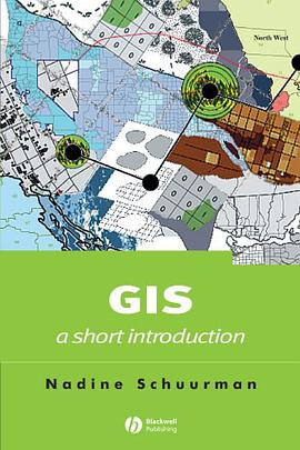
This guide enables students of human geography to take a critical look at the set of practices, hardware and software that are together described as GIS. A guide to GIS for students of human geography. Outlines the distinct approaches to inquiry employed in GIS and illustrates their relevance for human geographers. Traces the history of GIS and human geography from 1970 to the present. Illustrates the challenges of data collection, classification in the context of multiple stakeholders and epistemological approaches. Tracks the use of GIS in applied contexts through the stages of problem definition, data acquisition and classification, choice of software, spatial analysis and graphic output. Includes an inventory of tools and information related to GIS, including web-based resources. Supported by a website, www.blackwellpublishing.com/schuurman.
作者简介
Nadine Schuurman, Ph.D. University of British Columbia, 2000.
Department of Geography, Simon Fraser University, Faculty Member
Research Interests:
I am a GIScience (GIS) researcher with a focus on improving population health data and analysis in the interests of more reliable and more detailed spatial analysis. In the past, I have studied the processes by which theoretical knowledge is constructed in GIS with particular attention to generalization (the elimination of detail as scale decreases) and data models or the conceptual basis for representation in the digital realm. This theoretical emphasis led to an interest in data integration or ways of linking disparate data sets with some related elements. Typically it involves linkages between different registries within one jurisdiction or, alternatively, comparison of similar but not identical datasets between jurisdictions (e.g. provinces). My initial research in this area focused on ground water data. I developed a large data standardization project working with sub-surface groundwater data from bore-holes and created two graphical user interface (GUI) to standardize and classify this data for use in groundwater flow modelling
Since 2002, my research has focused on GIS and health informatics. This is the only GIS research program in Canada dedicated to the development of new technologies, methodologies and protocols for studying population health and health services using GIS and spatial data. I have a small research group (7 graduate students and research assistants) that is involved in several complementary and supporting projects. Our goal is to create a research environment that can assist policy makers and health administrators understand and rationalize choices about service provision based on spatial data, population vulnerability, access, service availability, trajectories and outcomes. I have four long-term research objectives: (i) develop decision frameworks for location of health services; (ii) build new spatial approaches to analyzing and characterizing access, availability and outcomes of trauma cases; and (iii) enhance the quality of semantic data linkages between multiple registries; and (iv) develop high resolution urban data sets that permit investigation of links between the built environment and population health.
(i) Decision frameworks for location of health services. Location/allocation of hospital services is a key component of a stream-lined health care system. I am working on spatial algorithms that will allow administrators to evaluate the catchment area associated with a specific service at any hospital and then determine the denominator population associated with that service area. This modelling tool will allow us to determine the population to be served by regional hubs and tertiary centres as well as regional age/sex proportions. I am also developing a Graphical User Interface (GUI) to this methodology so that policy makers will be able to visualize the effects of changes to service provision on the denominator population on-the-fly using icon-driven mapping software.
Another health services project involves using Multi-Criteria Evaluation (MCE) to evaluate optimal locations for adding or subtracting maternity care services in rural BC. This research is a small part of a larger CIHR grant (PIs: Drs. Jude Kornelson and Stefan Gryzbowski) developed to investigate the vulnerability of rural women based on access and availability of maternity care.
(ii)Spatial epidemiology of trauma/injury in Sub-Saharan Africa. I am a co-leader (with Dr. Morad Hameed, UBC) of a team that is setting up a trial trauma injury registry in Groote Schuur Hospital in Cape Town, South Africa. Using this data, we will analyze the spatial distribution of injury in Cape Town using Web 2.0 technologies. The spatial analysis will locate hot spots - or clusters - of injury. The team will then assess elements of the built and social environment that give rise to higher rates of injury. Both the data collection and analysis will result in protocols that can be used in Low and Medium Income Countries (LMIC) where the burden of injury is extremely high.
(iii) Geographic information surveillance team for Western Canada. I am a co-leader (with Dr. Morad Hameed) of a trauma surveillance group. Our goal is to a) develop a cohesive team of trauma researchers, GIS experts and biostatisticians to assess factors that influence trauma rates in BC and Alberta; b) develop unique spatial analysis and statistical measures that permit characterization of the effect of access and availability to trauma services and their links to outcome as well as the effect of socio-economic determinants on trauma incidence; and c) create an information sharing platform (ISP) to share peer-reviewed and grey trauma literature – in order to enhance knowledge transfer to the community and health authorities.
(iv) Enhancement of data linkages between health registries using semantic web technologies . Currently, many data linkages are based on “near-but-non-equivalent” semantic terms. The fields (e.g. still birth and fetal death) are assumed to equivalent while they actually encompass slightly different events and/or are based on different data sources. As a result, it is difficult to compare these data across provinces or link between registries. I developed a methodology to extract and encode extended metadata (data about data) based on interviews with database stewards (See Schuurman and Leszczynksi, 2006).
(v)A fifth area of my research is the development of high resolution spatial data for detailed micro-analysis of social epidemiology. This project extends the scope of GIS-based population health analysis by introducing four protocols that permit the building of high resolution urban cadastral data sets that can be integrated with census data in order to provide a richer and more detailed picture of socio-economic trends. My research team has developed this data for the Greater Vancouver Regional District (GVRD) and includes each individual property in the GVRD. These parcels can be linked with property value, lone-parent family status, land tenure; as well as household income. This research into the creation of very high-resolution spatial data sets has attracted much attention from health researchers; there is clear potential for analyzing micro-patterns in population health as a way of linking social determinants to health.
目录信息
读后感
评分
评分
评分
评分
用户评价
这本书名是GIS:a short introduction 据说是像Bible一样的书... 个人觉得很耐读~
评分这本书名是GIS:a short introduction 据说是像Bible一样的书... 个人觉得很耐读~
评分这本书名是GIS:a short introduction 据说是像Bible一样的书... 个人觉得很耐读~
评分这本书名是GIS:a short introduction 据说是像Bible一样的书... 个人觉得很耐读~
评分这本书名是GIS:a short introduction 据说是像Bible一样的书... 个人觉得很耐读~
相关图书
本站所有内容均为互联网搜索引擎提供的公开搜索信息,本站不存储任何数据与内容,任何内容与数据均与本站无关,如有需要请联系相关搜索引擎包括但不限于百度,google,bing,sogou 等
© 2026 book.quotespace.org All Rights Reserved. 小美书屋 版权所有


