

具體描述
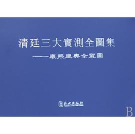
In Companions in Geography Mario Cams revisits the early 18th century mapping of Qing China, without doubt one of the largest cartographic endeavours of the early modern world. Commonly seen as a Jesuit initiative, the project appears here as the result of a convergence of interests among the French Academy of Sciences, the Jesuit order, and the Kangxi emperor (r. 1661-1722). These connections inspired the gradual integration of European and East Asian scientific practices and led to a period of intense land surveying, executed by large teams of Qing officials and European missionaries. The resulting maps and atlases, all widely circulated across Eurasia, remained the most authoritative cartographic representations of continental East Asia for over a century.
This book is based on Dr. Mario Cams' dissertation, which has been awarded the "2017 DHST Prize for Young Scholars" from the International Union of the History and Philosophy of Science and Technology, Division of History of Science and Technology (IUHPST/DHST).
著者簡介
Mario Cams, Ph.D. (University of Leuven, 2015), is Assistant Professor at the University of Macau’s Department of History and specializes in the history of early Sino-European contacts, late imperial China, and the history of cartography.
圖書目錄
List of Illustrations
Introduction: Towards a New Cartography of Cross-cultural Circulation
1Situating the Study
2Delineation and Approach
3Cartography and the Jesuit Missions to China
4Chapter Overview
1 Instruments for the Emperor: New Frontiers, New Practices
1.1An Instrumental Convergence of Interests
1.1.1The Académie and the Instrument Market in Paris
1.1.2The King’s Mathematicians’ Interest in Cartography
1.1.3Paris-made Instruments for the French Mission
1.2Improving Cartographies: An Emperor’s Quest
1.2.1The Kangxi Emperor’s Cartographic Aspirations
1.2.2Qing Statecraft and Cartographic Practice
1.2.3The Qing Court’s Appropriation of Paris-made Instruments
1.3Frontier Matters: New Qing Cartographic Practice
1.3.1Integrating the Khalka: Exploring a New Frontier
1.3.2The 1698 Preliminary Survey
1.3.3Re-standardizing the Qing’s Most Basic Unit of Length
Conclusion
Intermission One: Missionaries or Mapmakers? The Mapping Project and its Place in the Mission
Justifying Missionary Involvement
The Unauthorized Return of Joachim Bouvet
Conclusion
2 Of Instruments and Maps: The Land Surveys in Practice
2.1Beyond the Passes: Observations and Calculations
2.1.1New Qing Cartographic Practice along the Great Wall
2.1.2Revisiting the Manchu Homelands and Northern Frontiers
2.1.3Strategic Expeditions into Korea and Tibet
2.2The Logistics in Mapping the Chinese Provinces
2.2.1Moving South: Sequence, Timing and Strategies
2.2.2Directed from the Center: The Emperor and His Administration
2.2.3Team Composition and Local Support
2.3The Imperial Workshops Connection
2.3.1Mapmakers from the Inner Palace
2.3.2European Technical Experts and Assistants
2.3.3The Logistical Centrality of the Imperial Workshops
Conclusion
Intermission Two: Missionaries and Mapmakers: Missionary Activity during the Land Surveys
The Restitution of Church Buildings
The Impact of the Chinese Rites Controversy
Conclusion
3 The Afterlife of Maps: Circulation, Adaptation, and Negotiation
3.1The Printed Life of the Overview Maps of Imperial Territories
3.1.1The Woodblock Editions
3.1.2The Copperplate Editions
3.1.3Imperially Commissioned Compilations and Later Renditions
3.2The European Incorporation of a Qing Atlas
3.2.1Early Transmissions and Reception in Europe
3.2.2Contracting Jean-Baptiste Bourguingon d’Anville
3.2.3Intercultural Adaptation: d’Anville’s Regional Maps
3.3Beijing, Paris and Saint Petersburg: Negotiating the Gaps
3.3.1d’Anville’s General Maps and the Paris-Saint Petersburg Connection
3.3.2The Saint Petersburg Connection to Beijing
3.3.3d’Anville’s Maps: Reception and Further Adaptations
Conclusion
Annex: Extant Kangxi-era Sheets (Printed)
Conclusion: Unlocking Dichotomies: Revisiting Cross-cultural Circulation
On Qing Imperial Cartography: Traditional vs. Scientific Practice
On the Role of the Individual: Global vs. Local Networks
On Instruments and Maps: The Circulation vs. the Production of Knowledge
On Interculturality: China vs. Europe
References and Bibliography
Index
· · · · · · (收起)
讀後感
評分
評分
評分
評分
用戶評價
Counting by the hours he spent with western jesuit missionaries, Kangxi was truly a well-informed imperialist. A careful study of how Kangxi used the technology of cartography and land survey to make his expanding empire legible. In another way, one can argue that map-making and map-viewing are probably the best steroids for imperialists.
评分Counting by the hours he spent with western jesuit missionaries, Kangxi was truly a well-informed imperialist. A careful study of how Kangxi used the technology of cartography and land survey to make his expanding empire legible. In another way, one can argue that map-making and map-viewing are probably the best steroids for imperialists.
评分Counting by the hours he spent with western jesuit missionaries, Kangxi was truly a well-informed imperialist. A careful study of how Kangxi used the technology of cartography and land survey to make his expanding empire legible. In another way, one can argue that map-making and map-viewing are probably the best steroids for imperialists.
评分Counting by the hours he spent with western jesuit missionaries, Kangxi was truly a well-informed imperialist. A careful study of how Kangxi used the technology of cartography and land survey to make his expanding empire legible. In another way, one can argue that map-making and map-viewing are probably the best steroids for imperialists.
评分Counting by the hours he spent with western jesuit missionaries, Kangxi was truly a well-informed imperialist. A careful study of how Kangxi used the technology of cartography and land survey to make his expanding empire legible. In another way, one can argue that map-making and map-viewing are probably the best steroids for imperialists.
相關圖書


本站所有內容均為互聯網搜索引擎提供的公開搜索信息,本站不存儲任何數據與內容,任何內容與數據均與本站無關,如有需要請聯繫相關搜索引擎包括但不限於百度,google,bing,sogou 等
© 2025 book.quotespace.org All Rights Reserved. 小美書屋 版权所有